1991 Map of Albin
USGS Topo · Published 1995About this map
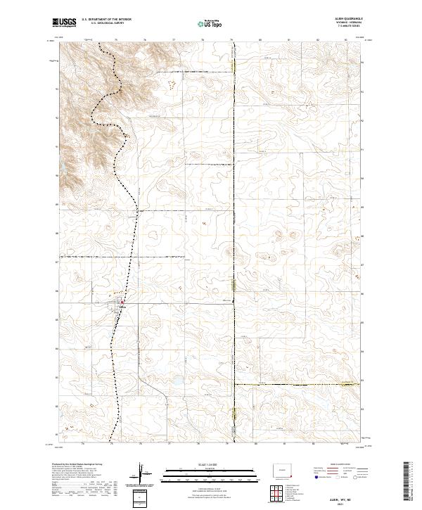
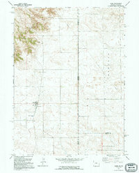
Albin serves as the primary hub of this High Plains landscape, where the agricultural economy is mapped at the intersection of Laramie, Banner, and Kimball counties. The terrain is defined by the high ground of Blair Hill to the northwest, while the southeastern corner reaches toward Bushnell. This 1991 inspection, based on imagery dating back to 1958, shows a rural infrastructure supported by a Radio Facility and a Sewage Disposal Pond, reflecting mid-to-late 20th-century utility development. The political geography is prominent, as State Line Road marks the boundary between Wyoming and Nebraska. Notable local landmarks for genealogists and historians include Albin Cem and the small settlement at Banner. The grid of roads, including Epworth, underscores the structured land-use patterns common to this tri-county border region.
Find a feature on this map
15 named features on this map. Tap any name to fly to it.
Don’t see what you’re looking for? This feature index may not catch every label — zoom into the map to look around manually.
Map Details
Editions of this 1991 Albin Map
This is the sole edition of this map. No revisions or reprints were ever made.
Historical Maps of Albin Through Time
5 maps found