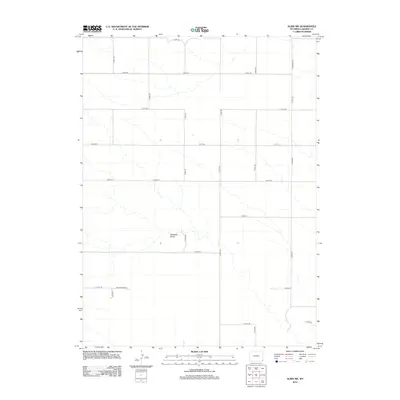
2012 Map of Albin SW
USGS Topo · Published 2012About this map
Antelope Draw meanders across this high plains landscape of Laramie County, defining the drainage patterns of an otherwise orderly grid of rural transport. The map reveals a highly structured section-line road network typical of the American West, featuring routes like Berggren Rd and a series of numbered county roads including Co RD-155 and Co RD-225. This 2012 survey by the U. S. Geological Survey captures the quiet, expansive nature of the region just before the mid-2010s, showing the specific layout of agricultural access and local infrastructure. Of particular note for researchers is the Telco Boundary, which indicates the spatial organization of utility service areas across these wide-open townships. The intersection of natural draws and man-made boundaries provides a clear look at how the terrain influenced the placement of roads like Co Rd-220 as they navigate the subtle contours of the Wyoming prairie.
Find a feature on this map
19 named features on this map. Tap any name to fly to it.
Don’t see what you’re looking for? This feature index may not catch every label — zoom into the map to look around manually.
Map Details
Editions of this 2012 Albin SW Map
This is the sole edition of this map. No revisions or reprints were ever made.
Other maps of this area

1954 · Cheyenne
USGS Topo · 1:250,000

1958 · Cheyenne
USGS Topo · 1:250,000

1963 · Pine Bluffs
USGS Topo · 1:24,000

1963 · Lindbergh
USGS Topo · 1:24,000

1963 · Burns
USGS Topo · 1:24,000

1963 · Midway SE
USGS Topo · 1:24,000
1963 · Round Top
USGS Topo · 1:24,000

1963 · Gurney Peak
USGS Topo · 1:24,000

1963 · Tracy
USGS Topo · 1:24,000

1968 · Pine Bluffs
USGS Topo · 1:24,000