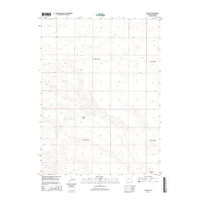
2015 Map of Albin SW
USGS Topo · Published 2015About this map
Antelope Draw and Chivington Draw cut through this corner of Laramie County, defining the drainage patterns of an open, high-plains landscape. This 2015 U.S. Geological Survey representation reveals a terrain dictated by the Public Land Survey System, with a rigid grid of section lines and county roads including Cr-157, Cr-160, and Cr-223.
Find a feature on this map
20 named features on this map. Tap any name to fly to it.
Don’t see what you’re looking for? This feature index may not catch every label — zoom into the map to look around manually.
Map Details
Editions of this 2015 Albin SW Map
This is the sole edition of this map. No revisions or reprints were ever made.
Other maps of this area

1954 · Cheyenne
USGS Topo · 1:250,000

1958 · Cheyenne
USGS Topo · 1:250,000

1963 · Pine Bluffs
USGS Topo · 1:24,000

1963 · Lindbergh
USGS Topo · 1:24,000

1963 · Burns
USGS Topo · 1:24,000

1963 · Midway SE
USGS Topo · 1:24,000
1963 · Round Top
USGS Topo · 1:24,000

1963 · Gurney Peak
USGS Topo · 1:24,000

1963 · Tracy
USGS Topo · 1:24,000

1968 · Pine Bluffs
USGS Topo · 1:24,000