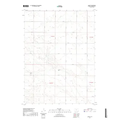
2017 Map of Albin SW
USGS Topo · Published 2017About this map
Chivington Draw and Antelope Draw carve subtle paths across this corner of Laramie County, defining the drainage patterns of an otherwise open High Plains landscape. The map reveals a strictly organized section-line road network, where routes like Co Rd 155 and Co Rd 160 follow the rigid grid of the Public Land Survey System. This intersection of natural topography and human geometry illustrates the late-era development of Wyoming's rural infrastructure, where watercourses still dictate the placement of local crossings despite the dominance of the township grid. For researchers, the map provides precise locations for modern county roads and the ephemeral water features that have influenced land use in the region for generations.
Find a feature on this map
21 named features on this map. Tap any name to fly to it.
Don’t see what you’re looking for? This feature index may not catch every label — zoom into the map to look around manually.
Map Details
Editions of this 2017 Albin SW Map
This is the sole edition of this map. No revisions or reprints were ever made.
Other maps of this area

1954 · Cheyenne
USGS Topo · 1:250,000

1958 · Cheyenne
USGS Topo · 1:250,000

1963 · Pine Bluffs
USGS Topo · 1:24,000

1963 · Lindbergh
USGS Topo · 1:24,000

1963 · Burns
USGS Topo · 1:24,000

1963 · Midway SE
USGS Topo · 1:24,000
1963 · Round Top
USGS Topo · 1:24,000

1963 · Gurney Peak
USGS Topo · 1:24,000

1963 · Tracy
USGS Topo · 1:24,000

1968 · Pine Bluffs
USGS Topo · 1:24,000