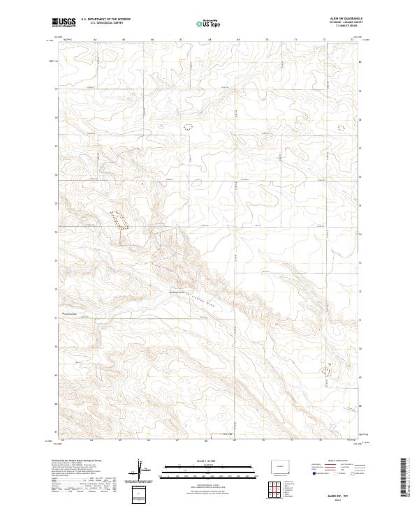
2021 Map of Albin SW
USGS Topo · Published 2021About this map
Antelope Draw and Chivington Draw cut through the high plains of Laramie County in this 2021 survey, illustrating the characteristic drainage patterns of the Wyoming landscape. The map highlights the systematic Public Land Survey System (PLSS) grid of Range 60 and 61 West, which heavily influenced the modern transportation network. A dense grid of rural corridors, including Co Rd 160 and Co Rd 225, follows these section lines, revealing the organized layout of agricultural properties and access routes. This detailed topographic study by the U.S. Geological Survey captures a sparsely populated region where the topography is defined by subtle elevation changes and seasonal watercourses rather than dense urban centers.
Find a feature on this map
19 named features on this map. Tap any name to fly to it.
Don’t see what you’re looking for? This feature index may not catch every label — zoom into the map to look around manually.
Map Details
Editions of this 2021 Albin SW Map
This is the sole edition of this map. No revisions or reprints were ever made.
Other maps of this area

1954 · Cheyenne
USGS Topo · 1:250,000

1958 · Cheyenne
USGS Topo · 1:250,000

1963 · Pine Bluffs
USGS Topo · 1:24,000

1963 · Lindbergh
USGS Topo · 1:24,000

1963 · Burns
USGS Topo · 1:24,000

1963 · Midway SE
USGS Topo · 1:24,000
1963 · Round Top
USGS Topo · 1:24,000

1963 · Gurney Peak
USGS Topo · 1:24,000

1963 · Tracy
USGS Topo · 1:24,000

1968 · Pine Bluffs
USGS Topo · 1:24,000