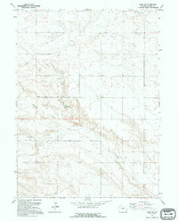
1991 Map of Albin SW
USGS Topo · Published 1995About this map
Chivington Draw and Antelope Draw define the topography of this corner of Laramie County, Wyoming, as it appeared in the early 1990s. The landscape reflects a mix of sparse agricultural land use and mineral extraction, with multiple Oil Wells and a Gravel Pit positioned across the terrain. These features, along with scattered Wells, suggest a rural economy reliant on subsurface resources and groundwater management in a region characterized by its expansive draws and drainage patterns. The mapping verified in 1994 captures the area's essential infrastructure before significant modern changes, providing a clear record of the section lines and township boundaries between T. 16 N. and T. 15 N. that organized the settlement of this high plains environment.
Find a feature on this map
6 named features on this map. Tap any name to fly to it.
Don’t see what you’re looking for? This feature index may not catch every label — zoom into the map to look around manually.
Map Details
Editions of this 1991 Albin SW Map
This is the sole edition of this map. No revisions or reprints were ever made.
Other maps of this area

1954 · Cheyenne
USGS Topo · 1:250,000

1958 · Cheyenne
USGS Topo · 1:250,000

1963 · Pine Bluffs
USGS Topo · 1:24,000

1963 · Lindbergh
USGS Topo · 1:24,000

1963 · Burns
USGS Topo · 1:24,000

1963 · Midway SE
USGS Topo · 1:24,000
1963 · Round Top
USGS Topo · 1:24,000

1963 · Gurney Peak
USGS Topo · 1:24,000

1963 · Tracy
USGS Topo · 1:24,000

1968 · Pine Bluffs
USGS Topo · 1:24,000