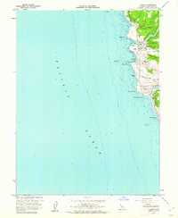
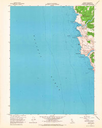
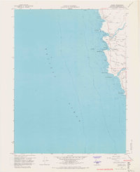
1960 Map of Albion
USGS Topo · Published 1962About this map
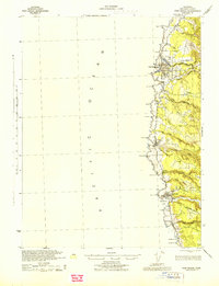
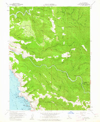
Albion sits perched above the Pacific Ocean in this early 1960s coastal survey, serving as a focal point for the rugged Mendocino coastline. The map documents the shifting landscape of industry and settlement, specifically marking Whitesboro (Site) near Whitesboro Cove, signaling a location where a former community once stood. Along the Albion River and the lower Navarro River, the terrain transitions from steep ridges like Albion Ridge to the low-lying Albion Flat. Notable landmarks for local history include scattered Grave and Graves sites, along with family-named features such as McPherson and Handley. This survey also provides hydrographic detail for the rocky shoreline, identifying hazards like Colby Reef and Bull Rock alongside prominent coastal points such as Navarro Head and Salmon Point.
Find a feature on this map
32 named features on this map. Tap any name to fly to it.
Don’t see what you’re looking for? This feature index may not catch every label — zoom into the map to look around manually.
Map Details
Editions of this 1960 Albion Map
3 editions found
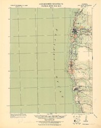
Other maps of this area

1920 · Glenblair
USGS Topo · 1:62,500
1920 · Fort Bragg
USGS Topo · 1:62,500
1943 · Glenblair
USGS Topo · 1:62,500
1943 · Fort Bragg
USGS Topo · 1:62,500
1943 · Albion
USGS Topo · 1:62,500
1943 · Navarro
USGS Topo · 1:62,500

1944 · Saddle Point
USGS Topo · 1:62,500

1957 · Ukiah
USGS Topo · 1:250,000

1960 · Ukiah
USGS Topo · 1:250,000
1960 · Elk
USGS Topo · 1:24,000