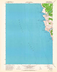
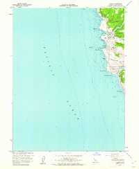
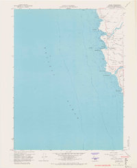
1960 Map of Albion
USGS Topo · Published 1967About this map
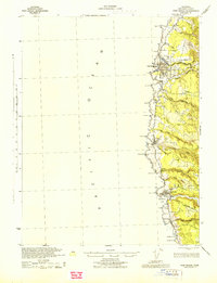
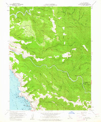
Albion sits perched above its namesake Albion Cove along this 1960 Mendocino coastline, showing a landscape defined by dramatic headlands and river mouths. The settlement at Albion is the primary hub, while further south, the map identifies the Whitesboro (Site) near Whitesboro Cove, signaling the legacy of earlier coastal industries. The topography is dominated by high coastal benches such as Albion Ridge and Navarro Ridge, which are separated by the deep incisions of the Albion River and Navarro River. These waterways terminate at distinctive maritime landmarks like Navarro Head and the Arch of the Navarro. Inland, the map records rural locations like Handley and a hillside Cem, providing specific points of interest for genealogists tracing family footprints in this timber and ranching region of Northern California.
Find a feature on this map
28 named features on this map. Tap any name to fly to it.
Don’t see what you’re looking for? This feature index may not catch every label — zoom into the map to look around manually.
Map Details
Editions of this 1960 Albion Map
3 editions found
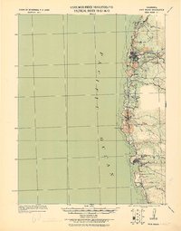
Other maps of this area

1920 · Glenblair
USGS Topo · 1:62,500
1920 · Fort Bragg
USGS Topo · 1:62,500
1943 · Glenblair
USGS Topo · 1:62,500
1943 · Fort Bragg
USGS Topo · 1:62,500
1943 · Albion
USGS Topo · 1:62,500
1943 · Navarro
USGS Topo · 1:62,500

1944 · Saddle Point
USGS Topo · 1:62,500

1957 · Ukiah
USGS Topo · 1:250,000

1960 · Ukiah
USGS Topo · 1:250,000
1960 · Elk
USGS Topo · 1:24,000