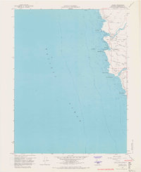
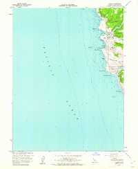
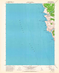
1960 Map of Albion
USGS Topo · Published 1967About this map
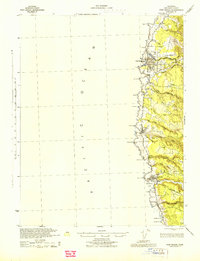
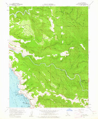
Albion River and the Navarro River carve deep estuaries into the Mendocino coast on this mid-century survey. The settlement of Albion is shown concentrated near the northern river mouth, with Albion Flat situated on the low-lying bank below the coastal bluffs. Further south, the former town of Whitesboro is identified as a site near the mouth of Big Salmon Creek, providing a clear location for a once-active lumber port.
Find a feature on this map
30 named features on this map. Tap any name to fly to it.
Don’t see what you’re looking for? This feature index may not catch every label — zoom into the map to look around manually.
Map Details
Editions of this 1960 Albion Map
3 editions found
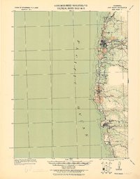
Other maps of this area

1920 · Glenblair
USGS Topo · 1:62,500
1920 · Fort Bragg
USGS Topo · 1:62,500
1943 · Glenblair
USGS Topo · 1:62,500
1943 · Fort Bragg
USGS Topo · 1:62,500
1943 · Albion
USGS Topo · 1:62,500
1943 · Navarro
USGS Topo · 1:62,500

1944 · Saddle Point
USGS Topo · 1:62,500

1957 · Ukiah
USGS Topo · 1:250,000

1960 · Ukiah
USGS Topo · 1:250,000
1960 · Elk
USGS Topo · 1:24,000