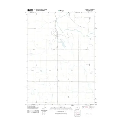
2012 Map of Alcester NE
USGS Topo · Published 2012About this map
Moe stands as a quiet locus in this agricultural section of the Iowa and South Dakota borderlands during the early twenty-first century. The landscape is primarily defined by the precision of the section-line road grid, including 480th Ave and 290th St, which segment the rolling plains. This rigid geometry is softened only by the meandering paths of local waterways like Sargeant Cr, Pattee Cr, and E Brule Cr.
Find a feature on this map
26 named features on this map. Tap any name to fly to it.
Don’t see what you’re looking for? This feature index may not catch every label — zoom into the map to look around manually.
Map Details
Editions of this 2012 Alcester NE Map
This is the sole edition of this map. No revisions or reprints were ever made.
Other maps of this area

1897 · Canton
USGS Topo · 1:125,000

1900 · Canton
USGS Topo · 1:125,000

1955 · Sioux Falls
USGS Topo · 1:250,000

1958 · Sioux Falls
USGS Topo · 1:250,000

1962 · Canton
USGS Topo · 1:24,000

1964 · Canton SW
USGS Topo · 1:24,000

1968 · Alcester NW
USGS Topo · 1:24,000

1968 · Alcester NE
USGS Topo · 1:24,000
1968 · Alcester
USGS Topo · 1:24,000
1968 · Alcester SE
USGS Topo · 1:24,000