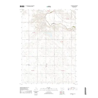
2017 Map of Alcester NE
USGS Topo · Published 2017About this map
The Big Sioux River carves a meandering boundary between Iowa and South Dakota, defining the landscape of this 2017 survey. The river's winding course creates a sharp contrast between the high, dissected bluffs of the Dakota side and the systematic agricultural grid of Sioux County, Iowa. This rural expanse is anchored by several long-standing community landmarks, including the small settlement of Moe and a network of Lutheran burial grounds. The distribution of Bethany Cem, Lands Lutheran Cem, and the dual North Trinity Cem and Trinity Lutheran Cem South reflects a deep-rooted history of Scandinavian or German immigrant settlement common to this region. Traces of historical hydrology are evident in the drainage patterns of Pattee Cr and E Brule Cr, which cut through the high ground before descending toward the river valley. The map documents a modern landscape where section roads like Co Hwy 140 and Arthur Ave overlay an older, river-dependent topography.
Find a feature on this map
40 named features on this map. Tap any name to fly to it.
Don’t see what you’re looking for? This feature index may not catch every label — zoom into the map to look around manually.
Map Details
Editions of this 2017 Alcester NE Map
This is the sole edition of this map. No revisions or reprints were ever made.
Other maps of this area

1897 · Canton
USGS Topo · 1:125,000

1900 · Canton
USGS Topo · 1:125,000

1955 · Sioux Falls
USGS Topo · 1:250,000

1958 · Sioux Falls
USGS Topo · 1:250,000

1962 · Canton
USGS Topo · 1:24,000

1964 · Canton SW
USGS Topo · 1:24,000

1968 · Alcester NW
USGS Topo · 1:24,000

1968 · Alcester NE
USGS Topo · 1:24,000
1968 · Alcester
USGS Topo · 1:24,000
1968 · Alcester SE
USGS Topo · 1:24,000