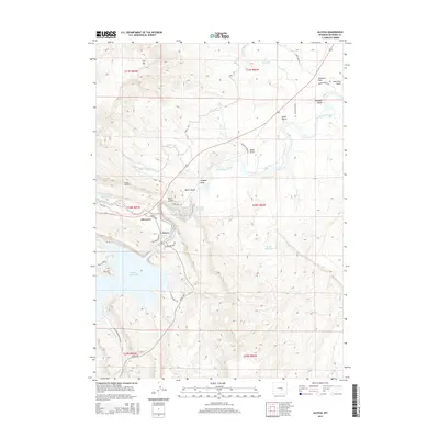
2015 Map of Alcova
USGS Topo · Published 2015About this map
Alcova Po and the town of Alcova sit at a critical hydraulic junction where the North Platte River meets a complex network of modern irrigation and power infrastructure. This landscape is defined by its massive water management projects, including the expansive Alcova Reservoir and the Gray Reef Reservoir, which dominate the central terrain. The map traces the winding path of the Casper Canal as it moves water through the high desert, aided by engineering works like Tunnel Number 2. Local landmarks such as Alcova Hot Springs and the numerous named draws and gulches, including Hogback Draw and Schrader Gulch, indicate a rugged topography shaped both by natural erosion and significant human reclamation efforts. The transition from the flat highlands of Flat Top to the deep river canyons reveals the strategic importance of this corridor for regional water storage and transport.
Find a feature on this map
40 named features on this map. Tap any name to fly to it.
Don’t see what you’re looking for? This feature index may not catch every label — zoom into the map to look around manually.
Map Details
Editions of this 2015 Alcova Map
This is the sole edition of this map. No revisions or reprints were ever made.
Other maps of this area

1950 · Alcova SE
USGS Topo · 1:24,000

1950 · Alcova
USGS Topo · 1:24,000

1951 · Clarkson Hill
USGS Topo · 1:24,000

1951 · Benton Basin
USGS Topo · 1:24,000

1951 · Bessemer Mountain
USGS Topo · 1:24,000

1951 · Bear Mountain
USGS Topo · 1:24,000

1951 · Benton Basin NE
USGS Topo · 1:24,000

1951 · Bear Spring
USGS Topo · 1:24,000

1951 · Pathfinder Dam
USGS Topo · 1:24,000

1955 · Casper
USGS Topo · 1:250,000