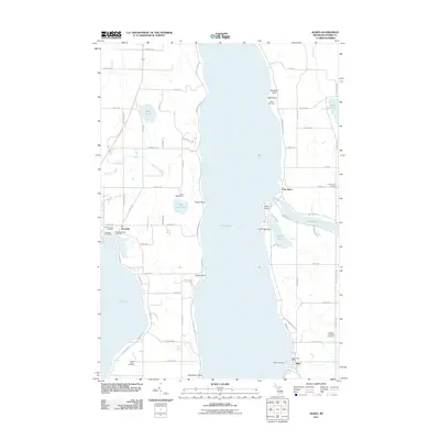
2011 Map of Alden
USGS Topo · Published 2011About this map
Torch Lake dominates the center of this landscape, its deep waters and elongated shoreline defining the geography between the settlements of Kewadin and Alden. The 2011 survey reveals a complex network of glacial lakes and connected waterways, including Elk Lake, Clam Lake, and the winding Clam River. Along the western shores, cultural heritage is preserved at the Kewadin Indian Cemetery and Sacred Heart Cemetery, marking the community's long-standing roots. On the eastern side, the village of Alden serves as a focal point near the mouth of Spencer Creek, while Valleau Landing provides a historic point of access to the water. This modern topography illustrates the transition of the region from a timber and agricultural hub toward its contemporary character as a destination for lakeside residence and recreation, highlighted by landmarks like Camp Maplehurst and Camp Fairwood. Numerous points of land, such as Deepwater Point and Lone Tree Point, suggest the intricate navigational history of these inland waters.
Find a feature on this map
84 named features on this map. Tap any name to fly to it.
Don’t see what you’re looking for? This feature index may not catch every label — zoom into the map to look around manually.
Map Details
Editions of this 2011 Alden Map
This is the sole edition of this map. No revisions or reprints were ever made.
Other maps of this area

1954 · Central Lake
USGS Topo · 1:62,500

1954 · Traverse City
USGS Topo · 1:250,000

1955 · Cheboygan
USGS Topo · 1:250,000

1956 · Mancelona
USGS Topo · 1:62,500

1957 · Elk Rapids
USGS Topo · 1:62,500

1958 · Cheboygan
USGS Topo · 1:250,000

1958 · Traverse City
USGS Topo · 1:250,000

1961 · Boyne City
USGS Topo · 1:62,500

1975 · Mancelona NW
USGS Topo · 1:24,000
1983 · Central Lake
USGS Topo · 1:25,000