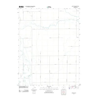
2012 Map of Alden NW
USGS Topo · Published 2012About this map
The Arkansas River winds through the northeast corner of this central Kansas landscape, where the flat alluvial plains are defined by a strict grid of section roads. The drainage pattern is complex, with Salt Cr meandering across the northern tier and Rattlesnake Cr cutting through the western portion. This area in Reno County shows a rural environment where water management is critical, evidenced by the West Canal and several significant local basins including Park Smith Lake and Lake Darrynane.
Find a feature on this map
34 named features on this map. Tap any name to fly to it.
Don’t see what you’re looking for? This feature index may not catch every label — zoom into the map to look around manually.
Map Details
Editions of this 2012 Alden NW Map
This is the sole edition of this map. No revisions or reprints were ever made.
Other maps of this area

1891 · Great Bend
USGS Topo · 1:125,000

1893 · Great Bend
USGS Topo · 1:125,000

1894 · Lyons
USGS Topo · 1:125,000

1955 · Great Bend
USGS Topo · 1:250,000

1957 · Great Bend
USGS Topo · 1:250,000

1957 · Ellinwood
USGS Topo · 1:24,000

1958 · Great Bend
USGS Topo · 1:250,000

1967 · Alden
USGS Topo · 1:24,000

1967 · Alden NW
USGS Topo · 1:24,000
1970 · Raymond
USGS Topo · 1:24,000