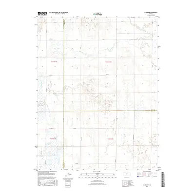
2015 Map of Alden NW
USGS Topo · Published 2015About this map
Arkansas River flows through the northeastern corner of this landscape, where the borders of Stafford, Rice, and Reno counties converge. This 2015 survey reveals a complex network of wetlands and intermittent waterways, particularly around Rattlesnake Cr and the evocative Dead Horse Slough. The terrain is defined by a grid of rural roads like Salt Marsh Rd and Sylvia Rd, which segment a region of significant hydrology. Named water bodies including Lake Darryman and Park Smith Lake suggest a landscape where water management and natural drainage patterns dictate the placement of local infrastructure and section lines.
Find a feature on this map
37 named features on this map. Tap any name to fly to it.
Don’t see what you’re looking for? This feature index may not catch every label — zoom into the map to look around manually.
Map Details
Editions of this 2015 Alden NW Map
This is the sole edition of this map. No revisions or reprints were ever made.
Other maps of this area

1891 · Great Bend
USGS Topo · 1:125,000

1893 · Great Bend
USGS Topo · 1:125,000

1894 · Lyons
USGS Topo · 1:125,000

1955 · Great Bend
USGS Topo · 1:250,000

1957 · Great Bend
USGS Topo · 1:250,000

1957 · Ellinwood
USGS Topo · 1:24,000

1958 · Great Bend
USGS Topo · 1:250,000

1967 · Alden
USGS Topo · 1:24,000

1967 · Alden NW
USGS Topo · 1:24,000
1970 · Raymond
USGS Topo · 1:24,000