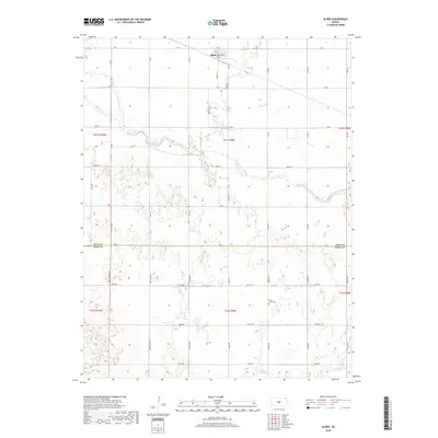
2018 Map of Alden
USGS Topo · Published 2018About this map
Alden anchors this central Kansas survey, situated just north of a prominent bend in the Arkansas River. The landscape is defined by the section-line grid of the Public Land Survey System, which organizes the rural transition from Rice County into Reno County. The northern portion of the quadrangle is bisected by Salt Creek, while the southern reaches are drained by Peace Cr.
Find a feature on this map
41 named features on this map. Tap any name to fly to it.
Don’t see what you’re looking for? This feature index may not catch every label — zoom into the map to look around manually.
Map Details
Editions of this 2018 Alden Map
This is the sole edition of this map. No revisions or reprints were ever made.
Other maps of this area

1894 · Lyons
USGS Topo · 1:125,000

1955 · Great Bend
USGS Topo · 1:250,000

1957 · Great Bend
USGS Topo · 1:250,000

1958 · Great Bend
USGS Topo · 1:250,000

1966 · Sterling SW
USGS Topo · 1:24,000

1967 · Alden
USGS Topo · 1:24,000

1967 · Alden NW
USGS Topo · 1:24,000
1967 · Sterling
USGS Topo · 1:24,000

1970 · Lyons
USGS Topo · 1:24,000
1970 · Raymond
USGS Topo · 1:24,000