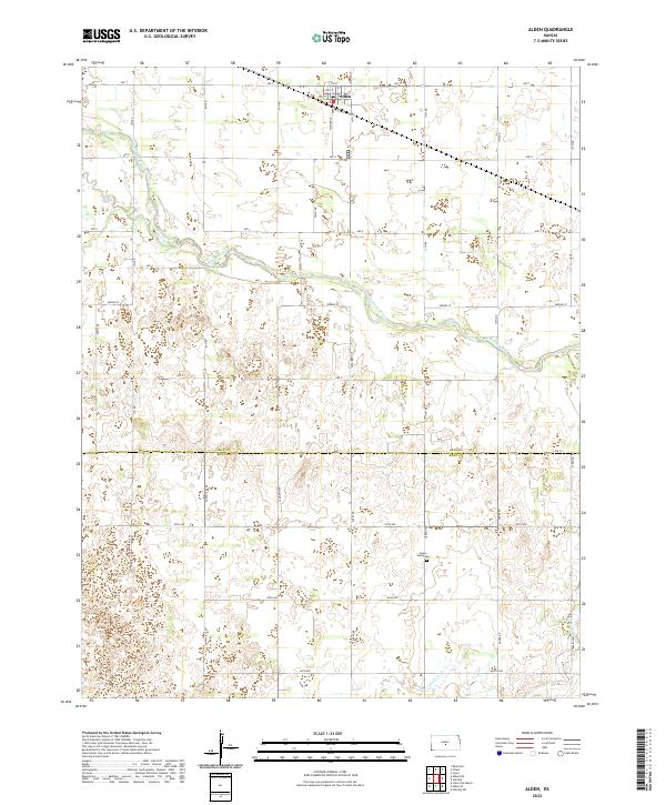
2022 Map of Alden
USGS Topo · Published 2022About this map
Alden anchors the northern portion of this Kansas landscape, situated near the winding course of the Arkansas River. This survey captures the rural character of the central plains at the boundary of Rice Co and Reno Co. The terrain is defined by a dense network of sectional roads, including Huntsville Rd, Langdon Rd, and Sterling Rd, which organize the agricultural fields and prairie. Waterways like Salt Creek and Peace Cr cut across the landscape, while the local geography is dotted with depression-like contours, characteristic of the region’s topography. Genealogists and historians will find the Peace Valley Cem in the southern half of the map, a quiet landmark amidst the expansive grid of 82nd Ave and 95th Ave.
Find a feature on this map
40 named features on this map. Tap any name to fly to it.
Don’t see what you’re looking for? This feature index may not catch every label — zoom into the map to look around manually.
Map Details
Editions of this 2022 Alden Map
This is the sole edition of this map. No revisions or reprints were ever made.
Other maps of this area

1894 · Lyons
USGS Topo · 1:125,000

1955 · Great Bend
USGS Topo · 1:250,000

1957 · Great Bend
USGS Topo · 1:250,000

1958 · Great Bend
USGS Topo · 1:250,000

1966 · Sterling SW
USGS Topo · 1:24,000

1967 · Alden
USGS Topo · 1:24,000

1967 · Alden NW
USGS Topo · 1:24,000
1967 · Sterling
USGS Topo · 1:24,000

1970 · Lyons
USGS Topo · 1:24,000
1970 · Raymond
USGS Topo · 1:24,000