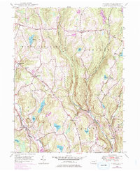
1946 Map of Aldenville
USGS Topo · Published 1976About this map
Dyberry Creek and the Lackawaxen River define the drainage of this Wayne County landscape, where the historic Newburgh Turnpike and Old Newburgh Turnpike cut across the high ridges of Mount Pleasant and Lebanon. The map reveals a post-war rural infrastructure transitioning into a modern recreation and conservation area, evidenced by the State Fish Hatchery near Miller Pond and the established Camp Towanda by Sunset Lake.
Find a feature on this map
38 named features on this map. Tap any name to fly to it.
Don’t see what you’re looking for? This feature index may not catch every label — zoom into the map to look around manually.
Map Details
Editions of this 1946 Aldenville Map
Other maps of this area

1892 · Honesdale
USGS Topo · 1:62,500

1920 · Long Eddy
USGS Topo · 1:62,500

1920 · Damascus
USGS Topo · 1:62,500

1921 · Long Eddy
USGS Topo · 1:48,000

1923 · Damascus
USGS Topo · 1:62,500

1923 · Long Eddy
USGS Topo · 1:62,500

1926 · Starrucca
USGS Topo · 1:62,500

1930 · Starrucca
USGS Topo · 1:48,000

1933 · Starrucca
USGS Topo · 1:62,500

1943 · Honesdale
USGS Topo · 1:125,000