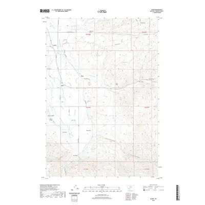
2020 Map of Alder
USGS Topo · Published 2020About this map
The Ruby River valley defines this landscape in Madison County, where a complex network of historic irrigation channels like the McFadden Ditch, Putnam Ditch, and Combs-Ditch Number-Two supports local agriculture. The settlements of Laurin, Ruby, and Alder are central hubs in this high-plains environment, connected by historic routes such as Mill Gulch Rd and Upper Ruby Rd. For genealogists and local historians, the map preserves the locations of the Laurin Cem and Taylor Cem, as well as named topographic features like The Island and Dry Hollow. The rugged eastern terrain is marked by numerous draws including Australia Gulch and the famous Alder Gulch, reflecting the area's rich history of water management and early Montana settlement patterns.
Find a feature on this map
58 named features on this map. Tap any name to fly to it.
Don’t see what you’re looking for? This feature index may not catch every label — zoom into the map to look around manually.
Map Details
Editions of this 2020 Alder Map
This is the sole edition of this map. No revisions or reprints were ever made.
Other maps of this area

1888 · Three Forks
USGS Topo · 1:250,000

1893 · Dillon
USGS Topo · 1:250,000

1894 · Three Forks
USGS Topo · 1:250,000

1895 · Three Forks
USGS Topo · 1:250,000

1947 · Bozeman
USGS Topo · 1:250,000

1948 · Bozeman
USGS Topo · 1:250,000

1949 · Varney
USGS Topo · 1:62,500

1950 · Virginia City
USGS Topo · 1:62,500

1955 · Bozeman
USGS Topo · 1:250,000

1955 · Dillon
USGS Topo · 1:250,000