1923 Map of Alderson
USGS Topo · Published 1945About this map
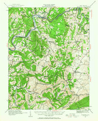
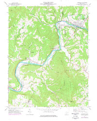
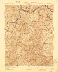
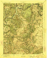
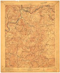
Alderson straddles the Greenbrier River as a primary rail hub during the early 1920s, serving as the focal point for this survey of Greenbrier, Monroe, and Summers counties. The Chesapeake and Ohio railroad follows the river's winding course, connecting riverside communities like Fort Spring, Glenray, and Pence Springs. The map reveals a densely settled agricultural landscape, documented through an exhaustive network of small schools such as Spider Den School, Mann School, and Indian Draft School. Industry of the era is represented by water-powered operations including Hokes Mill and Nickells Mill along Second Creek. South of the river, the terrain is defined by the steep ridges of Wolf Creek Mountain and Flattop Mountain, while the valley floors are dotted with long-established sites like Union and Sinks Grove P.O.. This survey captures the region just as the early automotive era began to connect these isolated Appalachian hollows and ridge-top settlements.
Find a feature on this map
114 named features on this map. Tap any name to fly to it.
Don’t see what you’re looking for? This feature index may not catch every label — zoom into the map to look around manually.
Map Details
Editions of this 1923 Alderson Map
3 editions found
Historical Maps of Ronceverte Through Time
4 maps found