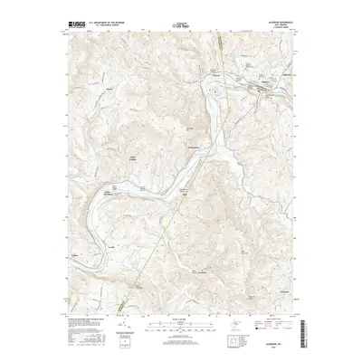
2016 Map of Alderson
USGS Topo · Published 2016About this map
The Greenbrier River dictates the layout of this West Virginia landscape, winding through a complex topography where the borders of Greenbrier, Summers, and Monroe counties converge. The town of Alderson serves as a primary hub, its street grid organized around thoroughfares like Riverview Ave W and E Chestnut Ave. Local history is anchored by several burial sites, including the Old Greenbrier Baptist Church Cem and the Alderson-Fletcher Addition Cem.
Find a feature on this map
107 named features on this map. Tap any name to fly to it.
Don’t see what you’re looking for? This feature index may not catch every label — zoom into the map to look around manually.
Map Details
Editions of this 2016 Alderson Map
This is the sole edition of this map. No revisions or reprints were ever made.
Other maps of this area

1887 · Hinton
USGS Topo · 1:125,000

1892 · Hinton
USGS Topo · 1:125,000

1912 · Meadow Creek
USGS Topo · 1:48,000

1912 · Big Bend
USGS Topo · 1:62,500

1914 · Big Bend
USGS Topo · 1:62,500

1915 · Meadow Creek
USGS Topo · 1:62,500

1921 · Alderson
USGS Topo · 1:48,000

1921 · Clintonville
USGS Topo · 1:48,000

1923 · Clintonville
USGS Topo · 1:62,500
1923 · Alderson
USGS Topo · 1:62,500