
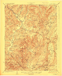
1923 Map of Clintonville
USGS Topo · Published 1923About this map
Blue Sulphur Springs sits nestled in the valley between The Swell and Sports Ridge, representing a landscape defined by its thermal springs and traditional Appalachian mountain agriculture. This 1920s survey captures a dense network of one-room schoolhouses and rural meeting houses, such as the Sam Black Church and St Johns Church, which served as the social anchors for scattered settlements like Meadow Bluff and Cornstalk.
Find a feature on this map
114 named features on this map. Tap any name to fly to it.
Don’t see what you’re looking for? This feature index may not catch every label — zoom into the map to look around manually.
Map Details
Editions of this 1923 Clintonville Map
2 editions found
Other maps of this area

1887 · Hinton
USGS Topo · 1:125,000

1887 · Lewisburg
USGS Topo · 1:125,000

1889 · Nicholas
USGS Topo · 1:125,000

1891 · Lewisburg
USGS Topo · 1:125,000

1891 · Nicholas
USGS Topo · 1:125,000

1891 · Huntersville
USGS Topo · 1:125,000

1892 · Hinton
USGS Topo · 1:125,000

1894 · Huntersville
USGS Topo · 1:125,000

1901 · Nicholas
USGS Topo · 1:125,000

1912 · Meadow Creek
USGS Topo · 1:48,000