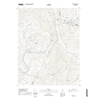
2019 Map of Alderson
USGS Topo · Published 2019About this map
The Greenbrier River carves a deep path through the mountains of Summers, Greenbrier, and Monroe Counties, anchoring the town of Alderson. This 2019 survey documents the river valley’s long-standing role as a corridor for transport and settlement, featuring the Alderson Bridge and several important regional landmarks. To the east, the Old Greenbrier Baptist Church and the adjacent Old Greenbrier Baptist Church Cem stand as significant historical sites. The terrain is marked by high points like Keeney Knob, topped by the Keeney Knob Fire Tower, and peaks such as Dempsey Mtn and Wolf Creek Mtn. Small settlements and locales like Pence Springs, Talcott, Glenray, and Elmhurst are connected by a network of rural roads and crossings, including the Pence Springs Bridge and the Hinton-Alderson Airport located in the river bottom near Riffe.
Find a feature on this map
104 named features on this map. Tap any name to fly to it.
Don’t see what you’re looking for? This feature index may not catch every label — zoom into the map to look around manually.
Map Details
Editions of this 2019 Alderson Map
This is the sole edition of this map. No revisions or reprints were ever made.
Other maps of this area

1887 · Hinton
USGS Topo · 1:125,000

1892 · Hinton
USGS Topo · 1:125,000

1912 · Meadow Creek
USGS Topo · 1:48,000

1912 · Big Bend
USGS Topo · 1:62,500

1914 · Big Bend
USGS Topo · 1:62,500

1915 · Meadow Creek
USGS Topo · 1:62,500

1921 · Alderson
USGS Topo · 1:48,000

1921 · Clintonville
USGS Topo · 1:48,000

1923 · Clintonville
USGS Topo · 1:62,500
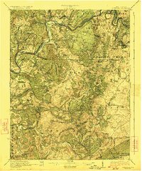
1923 · Alderson
USGS Topo · 1:62,500