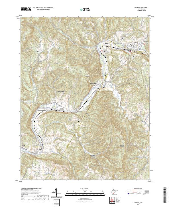
2023 Map of Alderson
USGS Topo · Published 2023About this map
Alderson sits at the heart of this landscape where the Greenbrier River carves a path through the ridge-and-valley terrain of the West Virginia highlands. The river’s importance to the regional economy and travel is underscored by the presence of historic crossing points like Haynes Ferry and Grahams Ferry, as well as the path of CSX Transportation following the water's edge. This modern survey illustrates the enduring settlement patterns of small communities like Pence Springs, Lowell, and Clayton, which are connected by a network of rural roads such as Clayton Rd and Blue Sulphur Springs Rd. Genealogists will find significant detail in the numerous burial grounds, including the Old Greenbrier Baptist Church Cem and Gwinn Memorial Cem. The geography is defined by high points like Wolf Creek Mountain and Patricks Peak, overlooking a valley where the Hinton-Alderson Airport serves the local aviation needs of the Greenbrier and Summers county borderlands.
Find a feature on this map
107 named features on this map. Tap any name to fly to it.
Don’t see what you’re looking for? This feature index may not catch every label — zoom into the map to look around manually.
Map Details
Editions of this 2023 Alderson Map
This is the sole edition of this map. No revisions or reprints were ever made.
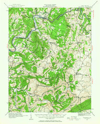
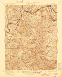
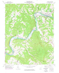
Historical Maps of Valley Heights Through Time
4 maps found