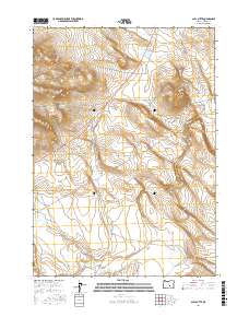
2017 Map of Alec Butte
USGS Topo · Published 2017About this map
Alec Butte anchors this high-desert landscape in Harney County, where the topography is defined by seasonal water drainage and remote access roads. The 2017 survey reveals a system of essential water infrastructure for ranching or land management, including Shroder Reservoir and Big Tank. These features serve as vital catchments in an area where ephemeral streams like Big Stick Cr, Wilson Cr, and Little Tank Cr carve through the basin. Connectivity across these townships is provided by a network of graded routes such as Big Stick Rd and Dry Valley Rd. This map reflects the enduring character of eastern Oregon's public and private lands, illustrating how natural relief and sparse water sources dictate the human footprint in the region.
Find a feature on this map
16 named features on this map. Tap any name to fly to it.
Don’t see what you’re looking for? This feature index may not catch every label — zoom into the map to look around manually.
Map Details
Editions of this 2017 Alec Butte Map
This is the sole edition of this map. No revisions or reprints were ever made.
Other maps of this area

1955 · Burns
USGS Topo · 1:250,000

1958 · Burns
USGS Topo · 1:250,000

1959 · Burns
USGS Topo · 1:250,000

1980 · Capehart Lake
USGS Topo · 1:24,000

1980 · Squaw Butte
USGS Topo · 1:24,000

1980 · Alec Butte
USGS Topo · 1:24,000

1980 · Hay Lake
USGS Topo · 1:24,000

1980 · Wagontire Mtn East
USGS Topo · 1:24,000

1980 · Lake on The Trail
USGS Topo · 1:24,000
1984 · Goose Egg Butte
USGS Topo · 1:24,000