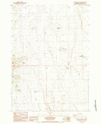
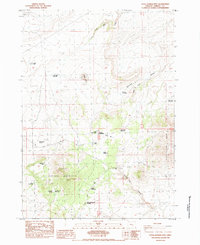
1984 Map of Goose Egg Butte
USGS Topo · Published 1984About this map
Hannah Myers Ranch anchors this high-desert landscape in the early 1980s, representing a point of human settlement within the expansive terrain of Harney County. The area is defined by its strategic water management and topographical landmarks, including the notable twin features of Lower Goose Egg Lake and Upper Goose Egg Lake situated near Goose Egg Butte. Evidence of early resource extraction and passage is found further west, where a Mine, Tunnel, and Prospect are located near East Pass and Horsehead Mtn.
Find a feature on this map
23 named features on this map. Tap any name to fly to it.
Don’t see what you’re looking for? This feature index may not catch every label — zoom into the map to look around manually.
Map Details
Editions of this 1984 Goose Egg Butte Map
This is the sole edition of this map. No revisions or reprints were ever made.
Other maps of this area

1955 · Burns
USGS Topo · 1:250,000

1958 · Burns
USGS Topo · 1:250,000

1959 · Burns
USGS Topo · 1:250,000

1980 · Alec Butte
USGS Topo · 1:24,000

1980 · Wagontire Mtn East
USGS Topo · 1:24,000

1980 · Lake on The Trail
USGS Topo · 1:24,000
1984 · Dry Valley Rim
USGS Topo · 1:24,000
1984 · Wilson Butte
USGS Topo · 1:24,000
1984 · Cox Canyon
USGS Topo · 1:24,000
1984 · Little Juniper Mountain
USGS Topo · 1:24,000