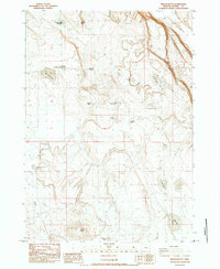
1984 Map of Wilson Butte
USGS Topo · Published 1984About this map
Wilson Butte and Shortys Butte dominate this high desert expanse of southeastern Oregon, where water management defines the landscape's utility. Compiled from 1981 photography, the map reveals a network of isolated water sources essential for livestock and wildlife, ranging from the Shortys Butte Waterhole in the north to the southern Sunset Lake. These small basins, often bearing descriptive or family names, suggest the area's history as rangeland.
Find a feature on this map
22 named features on this map. Tap any name to fly to it.
Don’t see what you’re looking for? This feature index may not catch every label — zoom into the map to look around manually.
Map Details
Editions of this 1984 Wilson Butte Map
This is the sole edition of this map. No revisions or reprints were ever made.
Other maps of this area

1955 · Burns
USGS Topo · 1:250,000

1958 · Burns
USGS Topo · 1:250,000

1959 · Burns
USGS Topo · 1:250,000

1980 · Lunch Lake
USGS Topo · 1:24,000
1980 · Flybee Lake
USGS Topo · 1:24,000

1980 · Iron Mtn. Flat
USGS Topo · 1:24,000

1980 · Alec Butte
USGS Topo · 1:24,000

1980 · Lake on The Trail
USGS Topo · 1:24,000
1984 · Dry Valley Rim
USGS Topo · 1:24,000
1984 · Goose Egg Butte
USGS Topo · 1:24,000