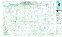
1984 Map of Aledo
USGS Topo · Published 1985About this map
The Mississippi River creates a dynamic western boundary for this mid-1980s landscape, where its complex network of side channels and islands includes the Mark Twain National Wildlife Refuge and Big Slough. Inland, the agricultural character of the region is defined by the Edwards River and Henderson Creek corridors, connecting established centers like Aledo and the communal history of Bishop Hill. The map documents a significant era of transit and land use, showing active rail lines such as the Burlington Northern alongside extensive stretches of abandoned trackage.
Find a feature on this map
152 named features on this map. Tap any name to fly to it.
Don’t see what you’re looking for? This feature index may not catch every label — zoom into the map to look around manually.
Map Details
Editions of this 1984 Aledo Map
This is the sole edition of this map. No revisions or reprints were ever made.
Other maps of this area

1890 · Durant
USGS Topo · 1:62,500

1891 · Davenport
USGS Topo · 1:62,500

1891 · Wilton Junction
USGS Topo · 1:62,500

1892 · Leclaire
USGS Topo · 1:62,500

1893 · Leclaire
USGS Topo · 1:62,500

1894 · Durant
USGS Topo · 1:62,500

1894 · Davenport
USGS Topo · 1:62,500

1899 · Clinton
USGS Topo · 1:125,000

1901 · Rock Island
USGS Topo · 1:125,000

1901 · Stanwood
USGS Topo · 1:125,000