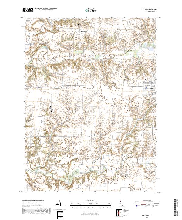
2024 Map of Aledo West
USGS Topo · Published 2024About this map
Edwards River and Pope Creek define the agricultural landscape of Mercer County, where deeply incised drainages carve through the prairie. The western outskirts of Aledo show a structured grid of residential streets, including SW 7th St and W Main St, while the unincorporated community of Millersburg sits further north along the Edwards River. This map is particularly valuable for genealogists, as it identifies numerous rural burying grounds scattered across the countryside, such as Peniel Cem, Brick Cem, and Oak Ridge Cem. These sites, alongside landmarks like McGaw Pond, provide essential spatial context for tracing early family plots and local history within this traditional Midwestern farming region.
Find a feature on this map
70 named features on this map. Tap any name to fly to it.
Don’t see what you’re looking for? This feature index may not catch every label — zoom into the map to look around manually.
Map Details
Editions of this 2024 Aledo West Map
This is the sole edition of this map. No revisions or reprints were ever made.
Other maps of this area

1912 · Milan
USGS Topo · 1:62,500

1916 · Edgington
USGS Topo · 1:62,500

1923 · Alexis
USGS Topo · 1:62,500

1925 · Alexis
USGS Topo · 1:62,500

1935 · Keithsburg
USGS Topo · 1:48,000

1938 · Edgington
USGS Topo · 1:62,500

1941 · Keithsburg
USGS Topo · 1:62,500

1944 · Milan
USGS Topo · 1:62,500

1953 · Buffalo Prairie
USGS Topo · 1:24,000
1953 · Aledo East
USGS Topo · 1:24,000