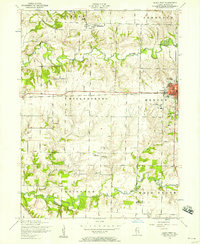
1953 Map of Aledo West
USGS Topo · Published 1958About this map
Aledo serves as the eastern anchor of this mid-century survey, revealing a town defined by its institutions, from the Roosevelt Military Academy and Mercer County Hospital to the Aledo Grammar School. The Chicago Burlington and Quincy railroad cuts a straight horizontal line across the center of the sheet, connecting the regional hub of Aledo with the smaller western settlement of Joy.
Find a feature on this map
35 named features on this map. Tap any name to fly to it.
Don’t see what you’re looking for? This feature index may not catch every label — zoom into the map to look around manually.
Map Details
Editions of this 1953 Aledo West Map
2 editions found
Other maps of this area

1912 · Milan
USGS Topo · 1:62,500

1916 · Edgington
USGS Topo · 1:62,500

1923 · Alexis
USGS Topo · 1:62,500

1925 · Alexis
USGS Topo · 1:62,500

1935 · Keithsburg
USGS Topo · 1:48,000

1938 · Edgington
USGS Topo · 1:62,500

1941 · Keithsburg
USGS Topo · 1:62,500

1944 · Milan
USGS Topo · 1:62,500

1953 · Buffalo Prairie
USGS Topo · 1:24,000
1953 · Aledo East
USGS Topo · 1:24,000