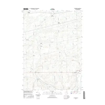
2016 Map of Alexander
USGS Topo · Published 2016About this map
Tonawanda Creek and its various tributaries, including Murder Creek and Bowen Cr, define the drainage and topography of this Genesee County landscape. The distribution of small settlements like East Pembroke, West Batavia, and Alexander reflects a long-standing agricultural and rural residential pattern characteristic of Western New York. Local history and genealogy are well-represented by several burial grounds, such as Hillside Cem and Maple Hill Cem. The map reveals a dense network of country roads, including the Alexander Darien Townline Rd, which connect these smaller hamlets to the larger regional hubs. In the southern portion of the sheet, the village of Attica sits near the winding course of Tonawanda Creek, while more obscure locales like Griswold and Sawens provide detail for those tracing family roots or local land use history.
Find a feature on this map
69 named features on this map. Tap any name to fly to it.
Don’t see what you’re looking for? This feature index may not catch every label — zoom into the map to look around manually.
Map Details
Editions of this 2016 Alexander Map
This is the sole edition of this map. No revisions or reprints were ever made.
Other maps of this area

1897 · Albion
USGS Topo · 1:62,500

1897 · Medina
USGS Topo · 1:62,500

1904 · Batavia
USGS Topo · 1:62,500

1905 · Attica
USGS Topo · 1:62,500

1944 · Alexander
USGS Topo · 1:31,680

1949 · Attica
USGS Topo · 1:62,500

1949 · Alexander
USGS Topo · 1:24,000
1949 · Akron
USGS Topo · 1:24,000

1949 · Cowlesville
USGS Topo · 1:24,000
1949 · Attica
USGS Topo · 1:24,000