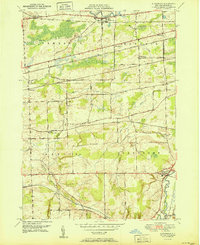
1951 Map of Alexander
USGS Topo · Published 1951About this map
Tonawanda Creek snakes through the northern and eastern portions of this Genesee County landscape, defining the rural character of a region heavily influenced by mid-century rail and road development. The settlement of Alexander anchors the southeast corner, while East Pembroke and West Batavia mark the northern corridor along the New York Central railroad. This survey captures a moment when traditional farming life and industrial transportation intersected, evidenced by the dense network of lines including the Lehigh Valley and Erie RR.
Find a feature on this map
57 named features on this map. Tap any name to fly to it.
Don’t see what you’re looking for? This feature index may not catch every label — zoom into the map to look around manually.
Map Details
Editions of this 1951 Alexander Map
This is the sole edition of this map. No revisions or reprints were ever made.
Other maps of this area

1897 · Albion
USGS Topo · 1:62,500

1897 · Medina
USGS Topo · 1:62,500

1904 · Batavia
USGS Topo · 1:62,500

1905 · Attica
USGS Topo · 1:62,500

1944 · Alexander
USGS Topo · 1:31,680

1949 · Attica
USGS Topo · 1:62,500

1949 · Alexander
USGS Topo · 1:24,000
1949 · Akron
USGS Topo · 1:24,000

1949 · Cowlesville
USGS Topo · 1:24,000
1949 · Attica
USGS Topo · 1:24,000