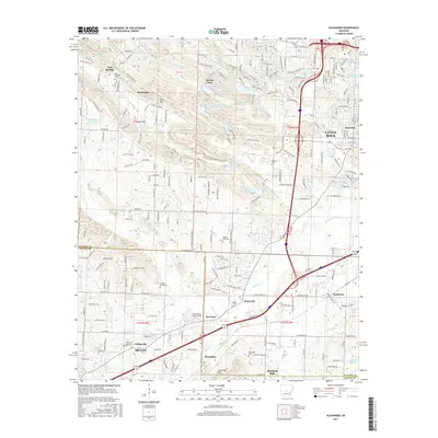
2017 Map of Alexander
USGS Topo · Published 2017About this map
Alexander sits at the southwestern edge of the Little Rock metropolitan area, straddling the line between Pulaski and Saline counties. The landscape transitions from suburban expansion near Rosedale and Terrytown to the more varied elevations of Alexander Mtn and Ellis Mtn. Significant burial grounds and memorial spaces are distributed across the quadrangle, including Pleasant Grove Cem, Valley Pine Cem, and the expansive Forest Hills Memorial Park. The drainage of Fourche Cr and its tributaries, such as Brodie Cr and Callahan Br, dictates much of the area's development pattern. To the west, smaller communities like Collegeville and Martindale maintain a more residential character, while the growing footprint of Bryant reflects the region's 21st-century residential sprawl along the Interstate 30 corridor.
Find a feature on this map
167 named features on this map. Tap any name to fly to it.
Don’t see what you’re looking for? This feature index may not catch every label — zoom into the map to look around manually.
Map Details
Editions of this 2017 Alexander Map
This is the sole edition of this map. No revisions or reprints were ever made.
Other maps of this area

1890 · Benton
USGS Topo · 1:125,000

1891 · Little Rock
USGS Topo · 1:125,000

1893 · Little Rock
USGS Topo · 1:125,000

1894 · Benton
USGS Topo · 1:125,000

1935 · Little Rock
USGS Topo · 1:24,000

1935 · North Little Rock
USGS Topo · 1:24,000

1935 · Alexander
USGS Topo · 1:48,000

1938 · Benton
USGS Topo · 1:48,000

1941 · Alexander
USGS Topo · 1:62,500

1943 · Pinnacle Mtn
USGS Topo · 1:31,680