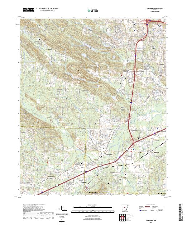
2024 Map of Alexander
USGS Topo · Published 2024About this map
Little Rock expands westward across the Pulaski and Saline County line on this modern survey, where suburban development meets the foothills of Ellis Mountain. The corridor is defined by the convergence of major transit arteries, including I-30 and Us 67 70, which connect the growing communities of Alexander, Bryant, and Terrytown. This infrastructure bridges the gap between established neighborhoods like Mabelvale and newer residential clusters near Spring Valley.
Find a feature on this map
67 named features on this map. Tap any name to fly to it.
Don’t see what you’re looking for? This feature index may not catch every label — zoom into the map to look around manually.
Map Details
Editions of this 2024 Alexander Map
This is the sole edition of this map. No revisions or reprints were ever made.
Other maps of this area

1890 · Benton
USGS Topo · 1:125,000

1891 · Little Rock
USGS Topo · 1:125,000

1893 · Little Rock
USGS Topo · 1:125,000

1894 · Benton
USGS Topo · 1:125,000

1935 · Little Rock
USGS Topo · 1:24,000

1935 · North Little Rock
USGS Topo · 1:24,000

1935 · Alexander
USGS Topo · 1:48,000

1938 · Benton
USGS Topo · 1:48,000

1941 · Alexander
USGS Topo · 1:62,500

1943 · Pinnacle Mtn
USGS Topo · 1:31,680