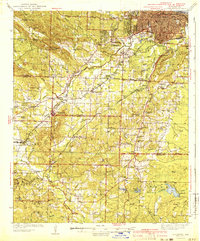
1941 Map of Alexander
USGS Topo · Published 1941About this map
Little Rock anchors the northeastern corner of this 1930s-era survey, revealing the early urban footprint and the site of the Old Penitentiary before the city's mid-century expansion. The landscape transitions quickly from the established streets of the capital to the industrial and agricultural corridors of Saline and Pulaski counties. The Bauxite mining district stands out as a major geographic and economic driver, surrounded by its namesake town and worker-populated settlements like Bryant and Brooks.
Find a feature on this map
96 named features on this map. Tap any name to fly to it.
Don’t see what you’re looking for? This feature index may not catch every label — zoom into the map to look around manually.
Map Details
Editions of this 1941 Alexander Map
2 editions found

Other maps of this area

1890 · Benton
USGS Topo · 1:125,000

1891 · Little Rock
USGS Topo · 1:125,000

1893 · Little Rock
USGS Topo · 1:125,000

1894 · Benton
USGS Topo · 1:125,000

1932 · Pastoria
USGS Topo · 1:62,500

1935 · Mc Almont
USGS Topo · 1:24,000

1935 · Little Rock
USGS Topo · 1:24,000

1935 · Sweet Home
USGS Topo · 1:24,000

1935 · North Little Rock
USGS Topo · 1:24,000

1935 · Alexander
USGS Topo · 1:48,000