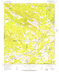
1954 Map of Alexander
USGS Topo · Published 1957About this map
Ellis Mountain and Alexander Mountain dominate the central topography of this 1950s survey, a period when the rural landscape between Alexander and Mabelvale was defined by specialized institutions and small-scale community hubs. Notable for genealogists and local historians are the numerous religious and social landmarks, such as Martindale Church, Quinn Chapel, and the Arkansas State Girls Training School. The map reveals a transition in land use, featuring the Salasco Sanatorium and multiple family-named burial sites including the McDonald Cemetery and Douglass Cemetery. Transportation corridors are well-established, with the Missouri Pacific and Chicago Rock Island and Pacific railroads cutting through the southern half of the quadrangle. The intersection of Pulaski and Saline County lines runs through this territory, showing how early settlements like Collegeville and Terrytown were oriented around the Fourche Creek drainage system and these emerging rail and road networks.
Find a feature on this map
71 named features on this map. Tap any name to fly to it.
Don’t see what you’re looking for? This feature index may not catch every label — zoom into the map to look around manually.
Map Details
Editions of this 1954 Alexander Map
This is the sole edition of this map. No revisions or reprints were ever made.
Other maps of this area

1890 · Benton
USGS Topo · 1:125,000

1891 · Little Rock
USGS Topo · 1:125,000

1893 · Little Rock
USGS Topo · 1:125,000

1894 · Benton
USGS Topo · 1:125,000

1935 · Little Rock
USGS Topo · 1:24,000

1935 · North Little Rock
USGS Topo · 1:24,000

1935 · Alexander
USGS Topo · 1:48,000

1938 · Benton
USGS Topo · 1:48,000

1941 · Alexander
USGS Topo · 1:62,500

1943 · Pinnacle Mtn
USGS Topo · 1:31,680