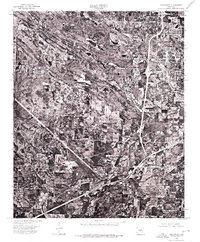
1975 Map of Alexander
USGS Topo · Published 1976About this map
The expanding outskirts of Little Rock dominate this mid-1970s orthophotomap, revealing the transition from forested tracts and agricultural plots to suburban development. The imagery, captured by the Arkansas Geological Commission and federal agencies, highlights the early highway corridors that began to define the region's movement. Near the southwestern edge, the community of Alexander appears as a distinct cluster of structures alongside the railroad, while the neighborhood of Mabelvale sits further east, integrated into the burgeoning road network. Because this is an orthophotoquad, it provides a direct visual record of land clearing, housing densities, and industrial footprints that traditional topographic line maps often generalize, offering researchers an unfiltered view of the landscape during a decade of significant growth in central Arkansas.
Find a feature on this map
3 named features on this map. Tap any name to fly to it.
Don’t see what you’re looking for? This feature index may not catch every label — zoom into the map to look around manually.
Map Details
Editions of this 1975 Alexander Map
This is the sole edition of this map. No revisions or reprints were ever made.
Other maps of this area

1890 · Benton
USGS Topo · 1:125,000

1891 · Little Rock
USGS Topo · 1:125,000

1893 · Little Rock
USGS Topo · 1:125,000

1894 · Benton
USGS Topo · 1:125,000

1935 · Little Rock
USGS Topo · 1:24,000

1935 · North Little Rock
USGS Topo · 1:24,000

1935 · Alexander
USGS Topo · 1:48,000

1938 · Benton
USGS Topo · 1:48,000

1941 · Alexander
USGS Topo · 1:62,500

1943 · Pinnacle Mtn
USGS Topo · 1:31,680