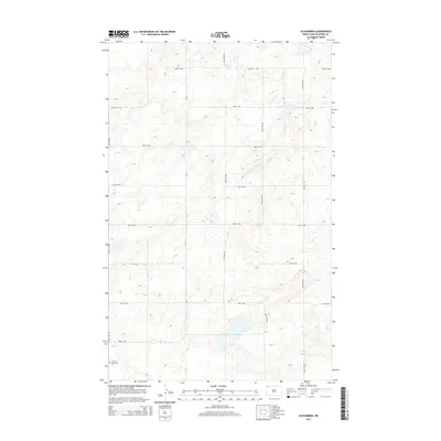
2014 Map of Alexandria
USGS Topo · Published 2014About this map
E Writing Rock Cem stands as a solitary historic anchor in the southwestern corner of this Divide County landscape. The terrain is defined by a dense network of glacial potholes and depressions typical of the Missouri Coteau, creating a complex natural drainage pattern that dictates the placement of the section-line road grid. Major local thoroughfares such as CR-7 and 100th St NW provide the primary framework for movement through this agricultural region. The map reveals the meticulous organization of the high plains, where long stretches of gravel roads like 141st Ave NW and 93rd St NW trace the edges of productive fields and natural wetlands, illustrating the enduring relationship between the township-and-range survey system and the prairie environment.
Find a feature on this map
16 named features on this map. Tap any name to fly to it.
Don’t see what you’re looking for? This feature index may not catch every label — zoom into the map to look around manually.
Map Details
Editions of this 2014 Alexandria Map
This is the sole edition of this map. No revisions or reprints were ever made.
Other maps of this area

1948 · Smoky Butte
USGS Topo · 1:24,000

1948 · Stady
USGS Topo · 1:24,000

1953 · Williston
USGS Topo · 1:250,000

1957 · Williston
USGS Topo · 1:250,000

1983 · Colgan West
USGS Topo · 1:24,000

1983 · Writing Rock North
USGS Topo · 1:24,000

1983 · Alexandria
USGS Topo · 1:24,000

1983 · Writing Rock South
USGS Topo · 1:24,000
1983 · Fortuna
USGS Topo · 1:24,000
1983 · Colgan East
USGS Topo · 1:24,000