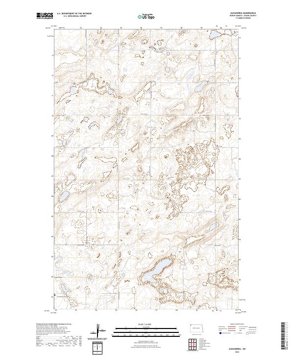
2024 Map of Alexandria
USGS Topo · Published 2024About this map
The Divide County Waterfowl Production Area dominates several sections of this landscape, reflecting the prairie pothole region's critical role in North Dakota conservation. This 2024 survey captures the township and range system in Northwest North Dakota, where the intersections of section line roads like 137th Ave NW and 98th St NW define the rural grid. Genealogists and local historians will find the East Writing Rock Cem in the southwestern corner, a significant landmark in a territory otherwise defined by small wetlands and agricultural plots. The map traces the precise boundaries of t162n r101w and neighboring townships, showing a transition between natural waterfowl habitats and the enduring North Dakota farmstead layout.
Find a feature on this map
20 named features on this map. Tap any name to fly to it.
Don’t see what you’re looking for? This feature index may not catch every label — zoom into the map to look around manually.
Map Details
Editions of this 2024 Alexandria Map
This is the sole edition of this map. No revisions or reprints were ever made.
Other maps of this area

1948 · Smoky Butte
USGS Topo · 1:24,000

1948 · Stady
USGS Topo · 1:24,000

1953 · Williston
USGS Topo · 1:250,000

1957 · Williston
USGS Topo · 1:250,000

1983 · Colgan West
USGS Topo · 1:24,000

1983 · Writing Rock North
USGS Topo · 1:24,000

1983 · Alexandria
USGS Topo · 1:24,000

1983 · Writing Rock South
USGS Topo · 1:24,000
1983 · Fortuna
USGS Topo · 1:24,000
1983 · Colgan East
USGS Topo · 1:24,000