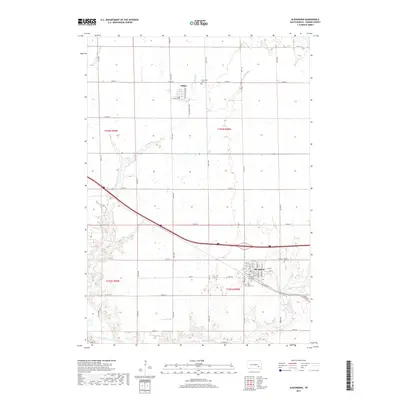
2017 Map of Alexandria
USGS Topo · Published 2017About this map
Alexandria and Fulton anchor this high-plains landscape in Hanson County, where the transition between cultivated section lines and the natural courses of Johnson Cr and Pierre Cr is clearly defined. The area is characterized by its organized grid of rural roads, including 417th Ave and 252nd St, which connect small-town life with the surrounding agricultural land. Genealogists will find significant value in the detailed locations of local burial grounds such as Graceland Cem north of Fulton and the Green Hill Cem and Saint Marys Cem situated on the outskirts of Alexandria. In the southwest corner, the James River snakes through the terrain, while Fulton Lake provides a distinct water feature amidst the rolling prairie. This study of the township captures the enduring layout of these South Dakota communities and the infrastructure that supports them.
Find a feature on this map
48 named features on this map. Tap any name to fly to it.
Don’t see what you’re looking for? This feature index may not catch every label — zoom into the map to look around manually.
Map Details
Editions of this 2017 Alexandria Map
This is the sole edition of this map. No revisions or reprints were ever made.
Other maps of this area

1899 · Alexandria
USGS Topo · 1:125,000

1955 · Sioux Falls
USGS Topo · 1:250,000

1957 · Alexandria
USGS Topo · 1:24,000

1957 · Ethan
USGS Topo · 1:24,000

1957 · Rockport Colony
USGS Topo · 1:24,000

1957 · Riverside
USGS Topo · 1:24,000

1957 · Farwell
USGS Topo · 1:24,000

1958 · Sioux Falls
USGS Topo · 1:250,000

1973 · Spencer SW
USGS Topo · 1:24,000

1973 · Ness Chain Lakes
USGS Topo · 1:24,000