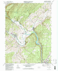
1994 Map of Alexandria
USGS Topo · Published 1997About this map
The Frankstown Branch Juniata River and the main stem of the Juniata River dominate this central Pennsylvania landscape, winding through a valley defined by the steep slopes of Tussey Mountain and Warrior Ridge. This 1994 update reveals the intersection of long-standing river settlements like Alexandria and Petersburg with the enduring industrial presence of the Conrail line. The map captures a mix of rural community landmarks, from the historic grounds of Juniata College and Juniata Valley High School to local burial sites such as Neff Cem and Bethel Ch.
Find a feature on this map
54 named features on this map. Tap any name to fly to it.
Don’t see what you’re looking for? This feature index may not catch every label — zoom into the map to look around manually.
Map Details
Editions of this 1994 Alexandria Map
This is the sole edition of this map. No revisions or reprints were ever made.
Other maps of this area

1901 · Huntingdon
USGS Topo · 1:62,500

1904 · Huntingdon
USGS Topo · 1:62,500

1919 · Menno
USGS Topo · 1:62,500

1922 · Mt Union
USGS Topo · 1:48,000

1923 · Tyrone
USGS Topo · 1:62,500

1924 · Mt. Union
USGS Topo · 1:62,500

1929 · Tyrone
USGS Topo · 1:48,000

1933 · Tyrone
USGS Topo · 1:62,500

1935 · Allensville
USGS Topo · 1:62,500

1938 · Allensville
USGS Topo · 1:62,500