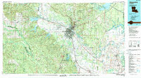
1986 Map of Alexandria
USGS Topo · Published 1986About this map
The Red River corridor defines the heart of Central Louisiana in this mid-1980s landscape, serving as the historical axis for Alexandria and Pineville. This region is characterized by a significant military and conservation footprint, where the large installations of England Air Force Base, Camp Beauregard, and a portion of the Fort Polk Military Reservation sit alongside the sprawling Kisatchie National Forest. The geography reveals a transition from the elevated Kisatchie Hills in the west to the alluvial basins and wetlands of the east, including the expansive Catahoula Lake.
Find a feature on this map
125 named features on this map. Tap any name to fly to it.
Don’t see what you’re looking for? This feature index may not catch every label — zoom into the map to look around manually.
Map Details
Editions of this 1986 Alexandria Map
2 editions found
Other maps of this area

1932 · Boyce NE
USGS Topo · 1:31,680

1932 · Boyce SW
USGS Topo · 1:31,680

1932 · Colfax SW
USGS Topo · 1:31,680

1932 · Colfax SE
USGS Topo · 1:31,680

1935 · Pawnee
USGS Topo · 1:31,680

1935 · Turkey Creek
USGS Topo · 1:62,500

1935 · Tooleys
USGS Topo · 1:62,500

1935 · Lecompte
USGS Topo · 1:62,500

1936 · Colfax
USGS Topo · 1:62,500

1936 · Pollock
USGS Topo · 1:62,500