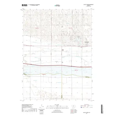
2017 Map of Alfalfa Center
USGS Topo · Published 2017About this map
The braided channels of the Platte River and the N Channel Platte River define this Nebraska landscape, creating a complex hydrologic network of islands and sloughs. Most notable is Long Island, a large landmass situated between the main river courses. This area south of the growing city of Kearney demonstrates the vital role of water management in the plains, centered around the historic Kearney Canal and several local water storage sites like Cottonmill Reservoir and Patterson Reservoir.
Find a feature on this map
67 named features on this map. Tap any name to fly to it.
Don’t see what you’re looking for? This feature index may not catch every label — zoom into the map to look around manually.
Map Details
Editions of this 2017 Alfalfa Center Map
This is the sole edition of this map. No revisions or reprints were ever made.
Other maps of this area

1894 · Kearney
USGS Topo · 1:62,500

1896 · Kearney
USGS Topo · 1:125,000

1955 · Grand Island
USGS Topo · 1:250,000

1957 · Grand Island
USGS Topo · 1:250,000

1958 · Grand Island
USGS Topo · 1:250,000

1961 · Amherst
USGS Topo · 1:24,000

1962 · Riverdale
USGS Topo · 1:24,000

1962 · Elm Creek East
USGS Topo · 1:24,000
1962 · Pleasanton SE
USGS Topo · 1:24,000
1962 · Kearney
USGS Topo · 1:24,000
Featured Places
- Kearney, NE
- Sheens Trailer Court, NE
- Cottonmill Mobile Home Court, NE
- Alfalfa Center, NE
- Buffalo County, NE