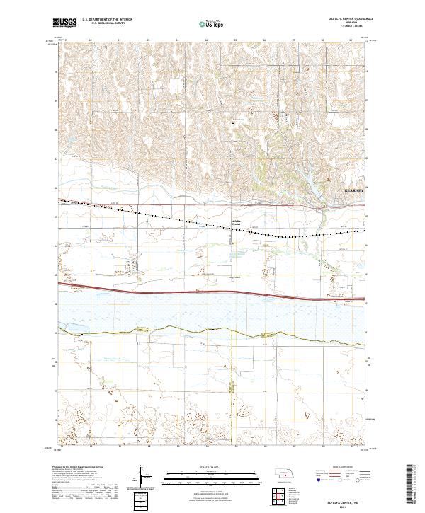
2021 Map of Alfalfa Center
USGS Topo · Published 2021About this map
Alfalfa Center serves as a central landmark in this 2021 study of the Buffalo County landscape, where the agricultural plains transition into the complex riparian environment of the Platte River valley. The North Channel Platte River flows through the southern portion of the sheet, carving out the prominent Long Island and creating a network of secondary waterways like Whisky Slough and Turkey Cr. These natural water systems are heavily integrated with man-made infrastructure, most notably the Kearney Canal which cuts across the terrain to support regional irrigation and water management.
Find a feature on this map
60 named features on this map. Tap any name to fly to it.
Don’t see what you’re looking for? This feature index may not catch every label — zoom into the map to look around manually.
Map Details
Editions of this 2021 Alfalfa Center Map
This is the sole edition of this map. No revisions or reprints were ever made.
Other maps of this area

1894 · Kearney
USGS Topo · 1:62,500

1896 · Kearney
USGS Topo · 1:125,000

1955 · Grand Island
USGS Topo · 1:250,000

1957 · Grand Island
USGS Topo · 1:250,000

1958 · Grand Island
USGS Topo · 1:250,000

1961 · Amherst
USGS Topo · 1:24,000

1962 · Riverdale
USGS Topo · 1:24,000

1962 · Elm Creek East
USGS Topo · 1:24,000
1962 · Pleasanton SE
USGS Topo · 1:24,000
1962 · Kearney
USGS Topo · 1:24,000
Featured Places
- Kearney, NE
- Sheens Trailer Court, NE
- Alfalfa Center, NE
- Cottonmill Mobile Home Court, NE
- Buffalo County, NE