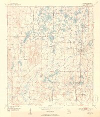
1952 Map of Alford
USGS Topo · Published 1953About this map
The Atlanta And St Andrews Bay railroad anchors this 1950s landscape of the Florida Panhandle, connecting the settlements of Alford, Steele City, and Round Lake. The geography is defined by a dense network of water bodies, notably the expansive Bellamy Bay, Peterson Bay, and Buchanan Bay, which dominate the central terrain. These wetlands are interspersed with high ground such as High Hill and Oak Hill, creating a mosaic of varied elevations and drainage patterns typical of Washington and Jackson counties.
Find a feature on this map
45 named features on this map. Tap any name to fly to it.
Don’t see what you’re looking for? This feature index may not catch every label — zoom into the map to look around manually.
Map Details
Editions of this 1952 Alford Map
3 editions found
Other maps of this area

1950 · Chipley
USGS Topo · 1:24,000

1950 · Wausau
USGS Topo · 1:24,000

1950 · Gap Lake
USGS Topo · 1:24,000

1951 · Chipley
USGS Topo · 1:24,000

1951 · Wausau
USGS Topo · 1:24,000

1951 · Gap Pond
USGS Topo · 1:24,000

1952 · Kynesville
USGS Topo · 1:24,000

1952 · Alford SE
USGS Topo · 1:24,000

1952 · Cottondale East
USGS Topo · 1:24,000

1952 · Cottondale West
USGS Topo · 1:24,000