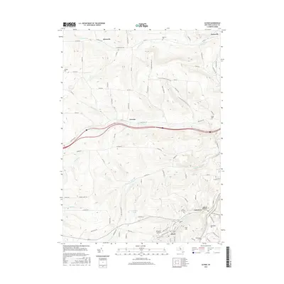
2016 Map of Alfred
USGS Topo · Published 2016About this map
Alfred and its adjacent educational institutions serve as the cultural and geographic center of this Allegany County landscape. The southern portion of the sheet is dominated by the sprawling campuses of SUNY Coll of Technology at Alfred and Alfred Univ, situated along the winding path of Canacadea Cr. This academic hub is surrounded by high ridges such as Pine Hill and Hamilton Hill, which separate the valley settlements from the rural uplands. In the north, the headwaters of the Canisteo River flow near the small hamlets of Hiltonville and Bishopville. The transition from the structured street grids of Tinkertown and Alfred Station to the winding rural routes like Karr Valley Rd highlights the area's mix of academic life and traditional agriculture. Notable family and community markers are found at Alfred Rural Cem and Lippincott Cem, while the N Country National Scenic Trail winds across the hills, marking the region's connection to broader trail systems.
Find a feature on this map
89 named features on this map. Tap any name to fly to it.
Don’t see what you’re looking for? This feature index may not catch every label — zoom into the map to look around manually.
Map Details
Editions of this 2016 Alfred Map
This is the sole edition of this map. No revisions or reprints were ever made.
Other maps of this area

1915 · Hornell
USGS Topo · 1:62,500

1916 · Canaseraga
USGS Topo · 1:62,500

1918 · Hornell
USGS Topo · 1:62,500

1926 · Wellsville
USGS Topo · 1:62,500

1926 · Greenwood
USGS Topo · 1:62,500

1940 · Canaseraga
USGS Topo · 1:62,500

1950 · Elmira
USGS Topo · 1:250,000

1958 · Elmira
USGS Topo · 1:250,000

1962 · Elmira
USGS Topo · 1:250,000
1964 · Alfred
USGS Topo · 1:24,000