
1962 Map of Elmira
USGS Topo · Published 1969About this map
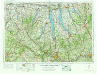
Seneca Lake and Cayuga Lake anchor this 1:250,000 scale survey, documenting the deep glacial valleys and surrounding ridges of the Finger Lakes region in the early 1960s. The landscape reflects a mix of heavy industrial nodes like Elmira and Corning alongside significant public and military lands, including the sprawling Seneca Army Depot and the Montezuma National Wildlife Refuge at the northern tip of Cayuga.
Find a feature on this map
154 named features on this map. Tap any name to fly to it.
Don’t see what you’re looking for? This feature index may not catch every label — zoom into the map to look around manually.
Map Details
Editions of this 1962 Elmira Map
4 editions found
Other maps of this area

1893 · Ithaca
USGS Topo · 1:62,500

1895 · Chittenango
USGS Topo · 1:62,500

1895 · Rochester
USGS Topo · 1:62,500

1895 · Ithaca
USGS Topo · 1:62,500

1895 · Elmira
USGS Topo · 1:62,500

1895 · Syracuse
USGS Topo · 1:62,500

1897 · Albion
USGS Topo · 1:62,500

1897 · Cazenovia
USGS Topo · 1:62,500

1898 · Rochester
USGS Topo · 1:62,500

1898 · Syracuse
USGS Topo · 1:62,500