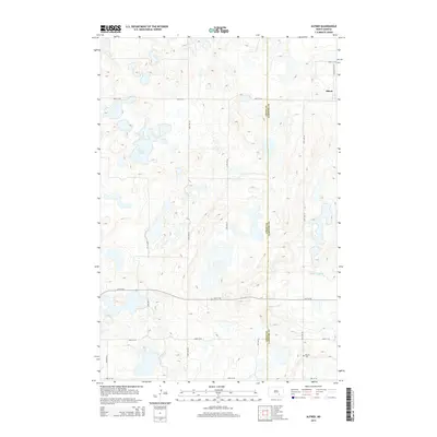
2014 Map of Alfred
USGS Topo · Published 2014About this map
The settlement of Alfred sits near the northeastern corner of this 2014 survey, a small cluster of development in an area defined by the glacial prairie pothole topography of the Missouri Plateau. This landscape is marked by numerous unnamed wetlands and depressions alongside larger water bodies like Arnies Lake. The rural character of the region is emphasized by its strict section-line road grid, where routes such as 64th Ave SE and 61st St SE segment the land into large agricultural tracts. An important point for genealogists and local historians is the Postal Cem, located in the southeastern portion of the quadrangle. The boundary between Logan Co and LaMoure Co runs vertically through the eastern half of the map, while Cottonwood Cr winds through the southern terrain, providing one of the few natural drainage features in this lake-dotted prairie.
Find a feature on this map
18 named features on this map. Tap any name to fly to it.
Don’t see what you’re looking for? This feature index may not catch every label — zoom into the map to look around manually.
Map Details
Editions of this 2014 Alfred Map
This is the sole edition of this map. No revisions or reprints were ever made.
Other maps of this area

1896 · Jamestown
USGS Topo · 1:125,000

1896 · Edgeley
USGS Topo · 1:125,000

1925 · Edgeley
USGS Topo · 1:125,000

1952 · Jud NW
USGS Topo · 1:24,000

1953 · Jamestown
USGS Topo · 1:250,000

1953 · Jud
USGS Topo · 1:24,000

1956 · Jamestown
USGS Topo · 1:250,000

1982 · Fredonia NW
USGS Topo · 1:24,000

1982 · Schlecht-Weixel Dam
USGS Topo · 1:24,000

1982 · Fredonia NE
USGS Topo · 1:24,000