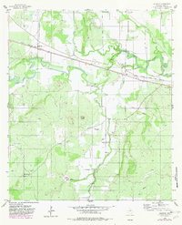
1956 Map of Algerita
USGS Topo · Published 1982About this map
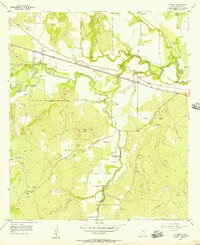
The San Saba River carves a winding path through this Central Texas landscape, defining the rural character of the region during the mid-1950s. The northern portion of the map is anchored by the Atchison Topeka and Santa Fe railroad, which parallels the river and serves the small community of Algerita. Settlement patterns here follow the creek valleys, with several small family and community burial grounds, such as China Creek Cemetery and Davidson Cemetery, dotting the terrain. The presence of the Wallace Creek Sch near the center of the sheet indicates a once-active local school district serving the surrounding ranchlands. To the south, the topography grows more distinct around the Harkey Knobs, where several seasonal waterways like Billie Branch and Robbins Branch drain into the primary river valley. Revisions from 1982 highlight changes in woodland cover and infrastructure, while maintaining the historical footprint of ranching outposts like the Ellis Ranch.
Find a feature on this map
25 named features on this map. Tap any name to fly to it.
Don’t see what you’re looking for? This feature index may not catch every label — zoom into the map to look around manually.
Map Details
Editions of this 1956 Algerita Map
2 editions found
Other maps of this area

1885 · San Saba
USGS Topo · 1:125,000

1894 · San Saba
USGS Topo · 1:125,000

1925 · San Saba 1-c
USGS Topo · 1:48,000

1928 · Goldthwaite
USGS Topo · 1:62,500

1930 · Richland Springs
USGS Topo · 1:62,500

1931 · Bend
USGS Topo · 1:62,500

1948 · Richland Springs
USGS Topo · 1:62,500

1948 · Goldthwaite
USGS Topo · 1:62,500
1950 · Richland Springs
USGS Topo · 1:62,500
1950 · Goldthwaite
USGS Topo · 1:62,500