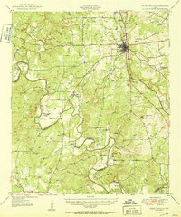
1950 Map of Goldthwaite
USGS Topo · Published 1950About this map
Goldthwaite sits at a geographic crossroads in the heart of Texas, where the Gulf Colorado and Santa Fe Railway cuts through the rolling hills of Mills County. The landscape is defined by the deep, looping meanders of the Colorado River, which forms the southwestern boundary between Mills and San Saba Counties. These river bends, such as Catclaw Bend and Smoky Bend, created isolated pockets of fertile land where early rural communities flourished.
Find a feature on this map
65 named features on this map. Tap any name to fly to it.
Don’t see what you’re looking for? This feature index may not catch every label — zoom into the map to look around manually.
Map Details
Editions of this 1950 Goldthwaite Map
This is the sole edition of this map. No revisions or reprints were ever made.
Other maps of this area

1885 · San Saba
USGS Topo · 1:125,000

1887 · Lampasas
USGS Topo · 1:125,000

1888 · Hamilton
USGS Topo · 1:125,000

1889 · Brownwood
USGS Topo · 1:125,000

1894 · Hamilton
USGS Topo · 1:125,000

1894 · Lampasas
USGS Topo · 1:125,000

1894 · Brownwood
USGS Topo · 1:125,000

1894 · San Saba
USGS Topo · 1:125,000

1925 · San Saba 4-a
USGS Topo · 1:48,000

1925 · San Saba 2-a
USGS Topo · 1:48,000